Construction Progress & Restoration Documentation
Clear, Consistent Aerial Documentation That Keeps Every Project on Track.
Smarter Oversight With High-Resolution Progress and Damage Documentation.
Precision Aerial Ops delivers accurate, real-time aerial intelligence for builders, contractors, developers, restoration firms, and insurance adjusters. Our drone-based documentation services provide a clear, consistent, and verifiable record of every stage of construction—or every detail of post-disaster restoration. Using high-resolution imaging, orthomosaic mapping, 3D modeling, and thermal analysis, we capture the data you need to keep projects on schedule, maintain quality control, verify compliance, and streamline communication between all stakeholders.
Whether you’re monitoring a multi-phase construction project or assessing storm, fire, or water damage, our aerial documentation ensures you always have reliable, defensible visual evidence to support decisions, reduce disputes, and improve project outcomes.
Services We Offer
-
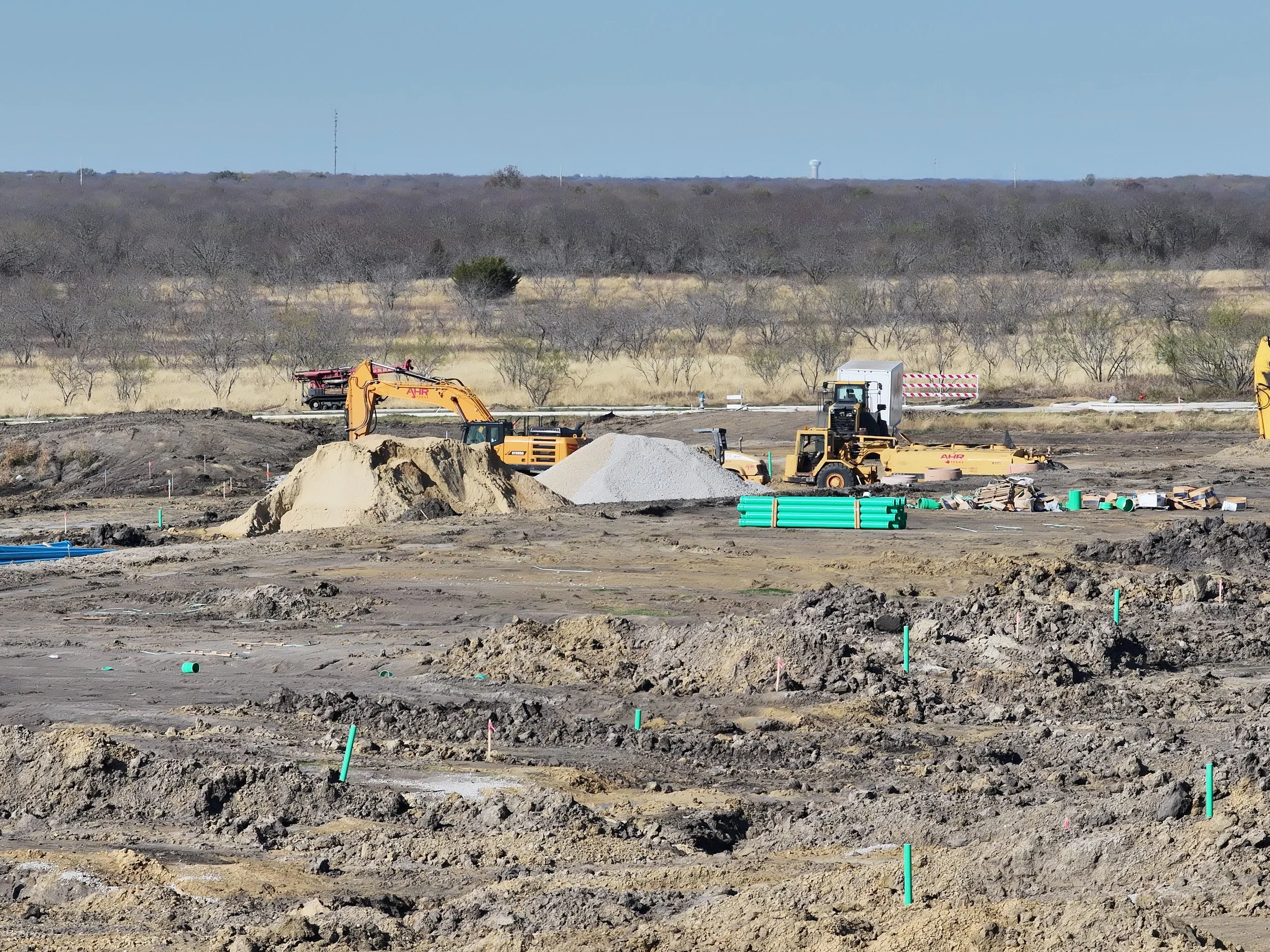
Construction Progress Documentation
Regularly scheduled drone flights (weekly, biweekly, or monthly) capture:
- Overhead and oblique site imagery
- High-resolution orthomosaics for plan overlays
- 3D models showing elevation, grading, and structure progress
- Timeline-based comparisons to track changes over time
- Visual confirmation of contractor performance and milestones
Ideal for general contractors, developers, architects, and investor reporting.
-
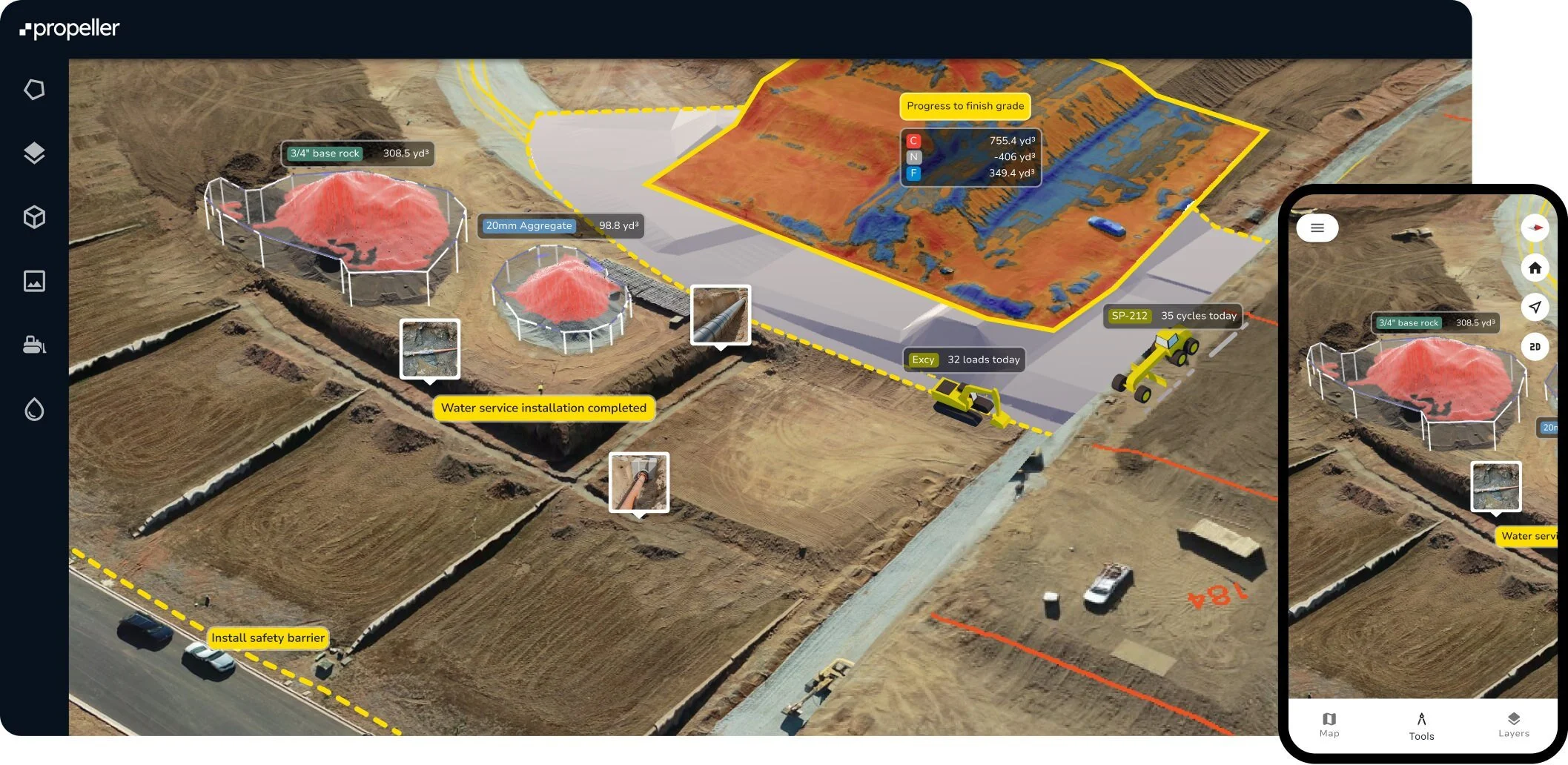
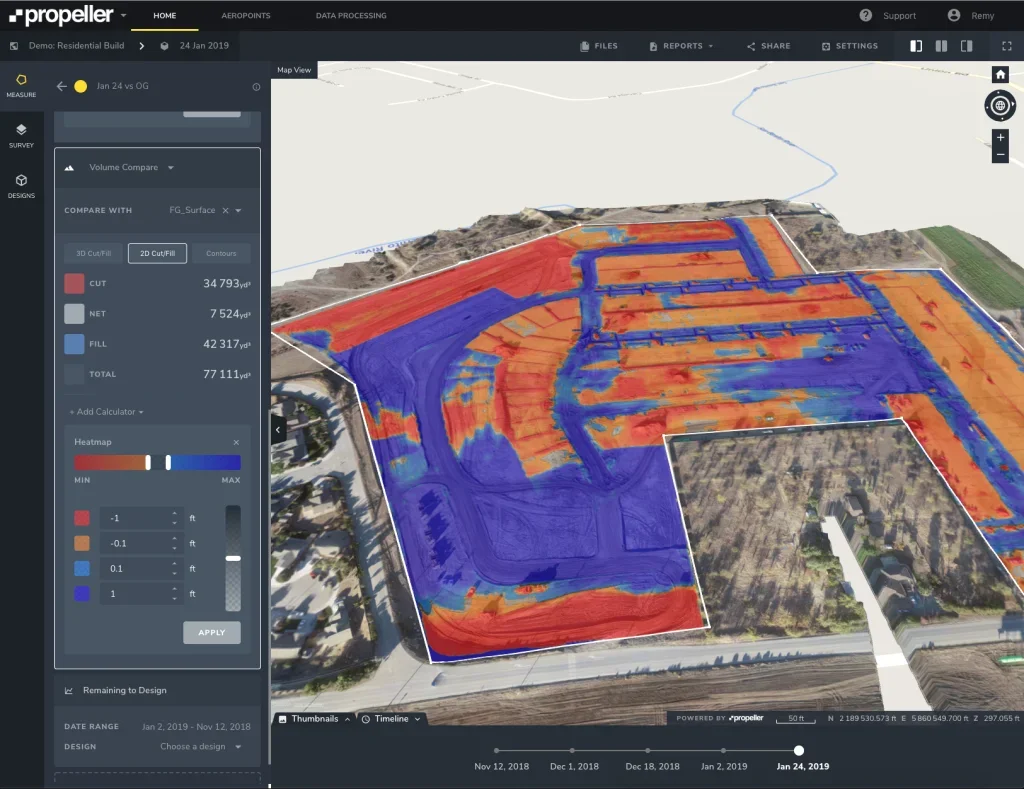
3D Modeling, Mapping & Volumetric Measurements
Our advanced mapping tools provide:
- Grading and earthwork verification
- Cut/fill analysis
- Stockpile measurements
- Material usage validation
- Site condition monitoring
Perfect for civil engineers, excavation teams, and material yards.
-

Restoration & Disaster Documentation
High-resolution aerial and ground-level imaging after:
- Hailstorms
- Wind events
- Flooding
- Fires
- Tornadoes
- Hurricanes
We capture detailed evidence of damage, including roof impacts, structural compromise, landscape changes, and property-wide destruction.
-

Thermal Imaging for Moisture & Heat Detection
Thermal sensors allow us to identify:
- Hidden moisture behind walls, roofs, and structural materials
- Insulation gaps
- Electrical hot spots
- Water intrusion patterns after storms or leaks
Restoration contractors and adjusters gain a complete understanding of the damage before repairs begin.
-

Compliance & Safety Documentation
Aerial data supports:
- OSHA compliance verification
- Site safety audits
- Hazard identification
- Perimeter security checks
- Environmental and erosion control documentation
-
Cloud-Based Deliverables & Shareable Reports
All images, maps, videos, and models are delivered through an easy-to-use, cloud-based portal where stakeholders can:
- Annotate findings
- Download reports
- Overlay plans
- Share updates instantly
With Precision Aerial Operations, every stage of construction or restoration is captured with clarity and precision. Our drone documentation services reduce risk, prevent costly delays, and provide a complete visual record your team can rely on—every step of the way.
Benefits
For Builders & Contractors
Maintain project timelines with accurate progress tracking
Verify subcontractor performance and completed work
Reduce disputes through timestamped visual documentation
Enhance communication with owners and investors
For Developers & Owners
Receive transparent updates on site progress
Improve oversight without needing to visit the jobsite
Ensure compliance, quality control, and milestone accountability
Your Project. Fully Documented. From Start to Finish.
For Insurance Adjusters
Speed up claim processing with clear, objective aerial evidence
Reduce re-inspections with high-resolution, defensible imagery
Improve accuracy in determining repair scope and value
Key Features
4K–5.1K High-Resolution Imaging
RTK/PPK Accuracy for Engineering-Grade Data
3D Models, DSM/DTM Maps, and Orthomosaics
Thermal Sensor Capability
FAA Part 107 Certified & Fully Insured Pilots
Fast Turnaround and Scheduled Recurring Flights
For Restoration Firms
Rapidly assess storm or disaster damage from above and below
Detect hidden moisture and structural issues early
Provide clients and insurers with authoritative before/after documentation