3 Ways Aerial Imagery Can Be Used To Advance Sustainability In Construction, City Planning And Natural Disaster Response
The first attempt at aerial imagery technology was little more than rudimentary cameras attached to kites with explosive charges triggering the camera to take a photo. Fast forward to 1915, and the first camera specifically designed to capture aerial imagery was invented and utilized by the British Royal Air Force, in which pilots in the cockpit took photos from an aerial camera placed on the floor of the plane to capture the activities of the German Army during World War I.
ByTony Agresta, Former Forbes Councils Member. for Forbes Business Development Council COUNCIL POST | Membership (fee-based)
Feb 08, 2023, 07:45am EST
Tony has extensive experience in sales, marketing, product management and operations for technology companies, including Nearmap.
The first attempt at aerial imagery technology was little more than rudimentary cameras attached to kites with explosive charges triggering the camera to take a photo. Fast forward to 1915, and the first camera specifically designed to capture aerial imagery was invented and utilized by the British Royal Air Force, in which pilots in the cockpit took photos from an aerial camera placed on the floor of the plane to capture the activities of the German Army during World War I.
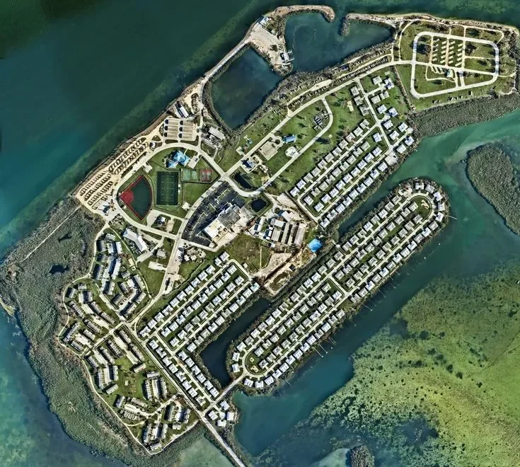
Today, aerial imagery and location technology have evolved to make impactful change, with cameras attached to drones flying around the world almost every day, enabling us to determine where climate change has had the most impact and where environmental efforts can be best allocated to address those issues. As a disclosure, such solutions are offered by my company Nearmap.
In this article, I will outline three ways leaders can leverage aerial imagery to maximize environmental sustainability in commercial construction projects, city planning and the support of municipalities contending with natural disasters.
1. Maximizing Environmental Sustainability In Commercial Construction Projects
It may seem implausible that the same technological concepts that aided armies in battle strategies are now being used to help combat the effects of climate change and ensure stable construction and infrastructure development, but they are. Aerial imagery and location technologies have made such strides that they now have applications to support efforts aimed at ensuring natural resources are safeguarded, and emissions are reduced throughout the construction and development process.
When considering the sheer output that’s required to survey a new construction project, it’s important not to overlook the environmental cost required to make that happen. The required personnel to preliminarily assess a site can be costly, and the carbon emissions required by personnel travel can be damaging to the environment. By substituting a “boots on the ground” model with highly precise aerial imagery, leaders can reduce the amount of travel needed to sites and cut down on their carbon footprint.
Given that many of the results of climate change are slow and occur over a long period of time, it can be difficult to accurately measure the impact of environmental deterioration. But new advancements now allow for flying drones carrying highly technical cameras capable of securing detailed images reflecting changes in land over time.
Digital aerial photography solutions can aid leaders in terms of insurance as well, in their outlining of valuable insights into areas impacted by natural disasters needed to ensure compliance with property laws and illustrate whether redevelopment is needed.
Whether due to severe droughts or flooding, erosion or landslides, aerial imagery technology can be leveraged to identify areas most impacted by climate change. This can aid businesses and property owners in creating accurate and comprehensive response plans for natural disasters.
2. Aerial Imagery As A Tool To Assess And Sustain Continued Growth of Cities
As a case example, consider Las Vegas—a bustling metropolis known around the world. But do people really know what it takes to keep this entertainment hub growing? As the fourth largest city in Nevada, development has triggered extensive innovation and a sharp uptick in population. In fact, Las Vegas has grown 33.4% since 2000.
In fact, it’s been in part through the use of aerial imagery technology and geospatial content that Las Vegas has been able to better identify existing areas in need of infrastructure updates and pinpoint ideal plots of land for continued development.
Meanwhile, Chicago has remained the most sought-after city for corporate investment for the past nine years. In 2022, Chicago saw an all-time record number of new and expanding corporate locations. With 59 million square feet of expansion or new space being accounted for, Chicago surpassed all other regions in the country by way of development.
To maintain standing as an attractive location for urbanization, aerial imagery can help simplify the location process and ensure contractors are identifying areas they can mold in their vision.
3. Preparing, Reacting And Rebuilding In The Wake Of Disaster With Aerial Imagery
The world is seeing an increase in climate disasters, with 20 weather-related disasters creating $145 billion in total combined damages overall for 2021. These increases necessitate a new way of planning and reacting to the impact of these events.
Aerial imagery and mapping technology can provide cities and states with the insights they need to effectively identify and assess areas of vulnerability prior to a weather catastrophe occurring, helping create a viable plan of action and rebuild in the wake of geographically altering events incidents.
A timely example of the way aerial imagery was used to assess damage from a natural disaster can be found in the wake of Hurricane Ian. The highly detailed images captured after its devastation allowed insurers, municipalities and construction companies to get detailed insights sooner by clearly mapping out the path of destruction and where resources must be allocated by local governments to assist in rebuilding.
When compared to images taken prior to Hurricane Ian, residents and local governments gained a clear understanding of the extent of the destruction by showing what impacted areas looked like pre- and post-Ian. This imagery ensured that states affected by the hurricane were able to quickly and efficiently identify expanses that required the most immediate attention.
For Leaders Considering Aerial Imagery As A Solution
Aerial imagery has come a long way since that first camera on a kite took flight. The technological advancements are evident in the way aerial imagery is being used to combat the effects of climate change, leveraged by cities to aid in their continued development and expansion and integrated by local governments to aid in disaster response plans and relief efforts. As this technology becomes more sophisticated, the potential for its implementation is limitless.
The Definitive Guide to Real Estate Aerial Drone Photography
Real estate aerial photography has become an integral part of the real estate industry, providing stunning visuals that showcase properties from a unique perspective.
This guide will provide you with all the essential information you may need to make informed decisions and leverage the power of aerial photography.
Written by Ian Port on May 21, 2024
Real estate aerial photography has become an integral part of the real estate industry, providing stunning visuals that showcase properties from a unique perspective.
Here, we’ll delve into the world of real estate aerial photography, exploring its benefits, suitable properties, aerial drone videos, how to find professional photographers, cost considerations and the process of capturing breathtaking aerial shots of your property.
Whether you're a real estate agent looking to enhance your listings, a photographer, or a homeowner seeking to showcase your property in its best light, this guide will provide you with all the essential information you may need to make informed decisions and leverage the power of aerial photography.
Real Estate Aerial Photography: An Overview and Its Benefits
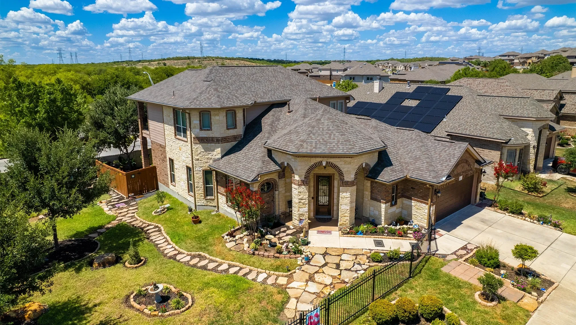
In the dynamic world of real estate, where first impressions can make all the difference, aerial drone photography has soared as a game-changer. This innovative technology allows real estate professionals to showcase their properties from breathtaking perspectives, offering unparalleled insights and helping capture the attention of potential buyers. By harnessing the power of aerial photography, real estate agents can not only elevate their marketing strategies but also can provide a truly immersive experience that helps empower buyers to envision themselves living in their dream homes.
Aerial photography helps unveil the full grandeur of any property, whether it’s a sprawling mansion with lush landscape or a suburban home with adjacent exterior features. With a bird's eye view, potential buyers can appreciate the home's location within the neighborhood, its proximity to key amenities and its commanding presence. Moreover, aerial shots effectively showcase outdoor features that might otherwise go unnoticed, such as expansive backyards, elegant pools, manicured gardens and beachfront properties.
The value of aerial photography extends far beyond its captivating aesthetics. Aerial images present an unparalleled opportunity to highlight unique selling points, enabling agents to underscore the distinguishing features that make a property truly special. Whether it's a new roof, a private terrace with breathtaking city views, an expansive backyard perfect for entertaining guests or a secluded garden offering a serene escape, aerial photography offers a visual narrative that speaks volumes. Buyers can instantly appreciate the property's potential, fostering a stronger emotional connection and reinforcing the allure of the property.
Properties That Benefit Most from Aerial Photography
Real estate aerial drone photography has taken the industry by storm. With the ability to capture breathtaking visuals from above, aerial photography offers a unique perspective that traditional photography simply can't match. But not all properties are equally suited for aerial photography. Certain characteristics and features make some properties more photogenic than others. Understanding which properties are best suited for aerial photography is crucial for real estate agents looking to leverage this technology effectively.
Properties that boast unique architectural features or distinctive landscaping often stand out in aerial photographs. A property with a sprawling garden, a glistening pool, or an eye-catching rooftop terrace instantly draws the viewer's attention. These elements add depth and visual interest to the overall shot, helping to make the property more appealing and memorable to potential buyers. Aerial photography allows these features to be showcased in all their glory, providing a comprehensive overview that traditional photography often fails to capture.
Properties located in scenic areas or with breathtaking views also benefit greatly from aerial photography. Coastal properties, for instance, offer stunning vistas of the ocean, while properties nestled amid lush greenery or picturesque mountains provide a sense of tranquility and escape. Aerial photographs can effectively capture the surrounding environment, giving potential buyers a glimpse of the lifestyle and amenities that the property has to offer.
However, location isn't the only factor to consider when choosing properties for aerial photography. Properties with unique shapes or interesting layouts can also make great candidates. A winding driveway, a secluded courtyard or an intricate roof design can add visual intrigue and create a sense of curiosity, enticing potential buyers to explore further.
Additionally, properties with ample outdoor living space are ideal for aerial photography. A spacious patio, a well-maintained lawn or an inviting pool area can be showcased in all their glory from an aerial perspective, highlighting the property's potential for relaxation and entertainment.
Understanding Aerial Drone Videos and How to Use Them Effectively
In addition to aerial photographs, real estate agents can also leverage the power of aerial drone videos to showcase properties. These videos provide a dynamic and immersive experience for potential buyers, allowing them to virtually explore the property and its surroundings from a unique perspective.
When creating aerial drone videos, it's important to capture footage that highlights the property's best features. This includes showcasing the architectural details, landscaping, outdoor living spaces and any nearby amenities. Drone videos also provide an excellent opportunity to showcase the property's location, providing viewers with a sense of the surrounding neighborhood and community.
To use aerial drone videos effectively, real estate agents should consider incorporating them into their marketing strategies. They can be shared on social media platforms, real estate websites and property listings. Additionally, drone videos can be used as a powerful tool during property tours, allowing agents to provide potential buyers with a comprehensive overview of the property and its surroundings.
Here are some tips for using aerial drone videos effectively in real estate marketing:
Keep the videos short and focused: Aerial videos should be concise and to the point, capturing the property's highlights without overwhelming viewers with too much information.
Use smooth transitions and cinematic shots: Use professional editing techniques to create smooth transitions between shots and incorporate cinematic elements to enhance the overall viewing experience.
Add relevant background music: If you choose to add music, be sure to use music that complements the video's tone and enhances the overall atmosphere to create an engaging and immersive experience.
Feature property highlights: Showcase the unique features and amenities of the property, drawing attention to its most desirable aspects.
By incorporating these tips, real estate agents can leverage the power of aerial drone videos to create captivating marketing materials that effectively showcase properties and attract potential buyers.
Finding Qualified Aerial Photographers: Tips and Considerations
When searching for qualified and experienced aerial photographers, real estate agents should consider several key factors. First, it's important to look for photographers who specialize in real estate aerial photography, as they are more likely to have a strong understanding of the unique requirements and techniques needed for capturing effective images of properties. Additionally, photographers should have a proven track record of success, with a portfolio showcasing their previous work in the real estate industry. Zillow Media Experts has experienced drone photographers and offers aerial photography and aerial videography as options in their packages.
Another important consideration is the photographer's equipment and technology. Professional aerial photographers typically use high-quality drones equipped with advanced cameras capable of capturing high-resolution images and videos. It's also essential for photographers to have experience operating drones safely and legally, adhering to all relevant aviation regulations and local laws.
Furthermore, real estate agents should consider the photographer's creativity and artistic style. Aerial photography requires a keen eye for composition, lighting and overall aesthetics. Photographers who produce visually stunning and engaging images that effectively showcase the property's best features can be highly valuable in attracting potential buyers.
Finally, it's important to establish clear communication and expectations with the photographer before hiring them. This includes discussing the specific goals and requirements for the aerial photography project, including the desired shots, angles and any special considerations. By carefully considering these factors, real estate agents can find qualified and experienced aerial photographers who can deliver exceptional results that effectively showcase their properties.
Aerial Photos and Videos: Understanding the Costs
The cost of aerial photos and videos can vary widely depending on several factors. It is important for real estate agents to understand these factors to ensure they can budget appropriately when hiring an aerial photographer. The specific cost will depend on the photographer's experience, the duration of the shoot, the equipment used and the location of the property.
Several factors affect the cost of aerial photography and videography services. A significant factor is the photographer's experience and reputation. More experienced photographers with a proven track record of success may charge higher rates than less experienced photographers. The duration of the shoot is another important factor. Longer shoots will naturally cost more than shorter shoots.
Additionally, the type of equipment used can affect the cost of the shoot. Aerial photography and videography can be done using a variety of drones, from small, consumer-grade drones to larger, professional-grade drones. The type of drone used will affect the quality of the footage and the cost of the shoot. Finally, the location of the property can also affect the cost of the shoot. Shoots in remote or difficult-to-reach locations will typically cost more than shoots in easily accessible locations.
By understanding these factors, real estate agents can set realistic budgets for their aerial photography and videography needs. By taking the time to research and hire a qualified photographer, real estate agents can ensure they receive high-quality aerial content to showcase their properties.
Process and Preparations for Aerial Photography on Your Property
When it comes to scheduling an aerial photography session for your property, there are a few essential steps to follow to help ensure a successful shoot. First, reach out to reputable aerial photographers familiar with real estate photography and ask for their availability for a preferred date. Communicate your specific requirements, such as the type of shots you want and the timeframe required, and discuss any logistical considerations.
Adequate preparation helps facilitate a smooth photography session. Making sure your property's exterior is tidy and presentable is crucial in presenting the most favorable impression to potential buyers. This might involve tasks like trimming the lawn, arranging outdoor furniture and clearing away any clutter from the surrounding area. If there are particular parts of the property you want to be highlighted, like a swimming pool or garden, make sure they are well-maintained and visually appealing.
On the day of the photography session, weather conditions should be taken into account, as they can dramatically influence the quality of the shots. Choose a day with clear skies and favorable lighting conditions; if possible, early morning or late afternoon shoots often offer the best light quality. It's recommended to schedule a pre-session consultation with the photographer, allowing you to discuss specific shot requirements, property highlights and any concerns you might have. This open line of communication helps streamline the photography process and ensures both parties are aligned on their objectives.